Parish LINTON, Scotland
LINTON & BIRD Chronicles, Volume VI, Issue 1, Spring © 2011, ISSN 1941-3521
Parish Linton
A Topographical Dictionary of Scotland by Samuel Lewis Year published 1846, pages 175-197
(Reprinted) LINTON & BIRD Chronicles Volume I, Issue 3, © Fall 1984
Linton Research Fund Inc. Publication © 2011
LINTON & BIRD CHRONICLES, Volume VI, Issue 1, Spring © 2011, ISSN 1941-3521___________________________
LINTON, a parish, in the district of Kelso, county of Roxburgh, 6 miles (S. E. by S.) from Kelso; containing 526 inhabitants, of whom 40 are in the hamlet. This place derives its name, signifying "the town of the lakes," from its situation once on the north-west border of a lake of great extent called Linton loch, and from another lake designated Hoselaw, in the eastern extremity of the parish. The church appears to have been bestowed in the reign of David I. upon the abbey of Kelso by Sir Richard Cumyn, ancestor of John Cumyn who aspired to the crown of Scotland; and the lands of the parish were granted in the reign of William the Lion to William de Somerville, son of Roger, Baron of Whichnor, in England, as a reward for his having destroyed a ferocious animal which committed great depredation in the neighbourhood. He was afterwards made principal falconer to the Scottish king, and sheriff of Roxburghshire; and resided in the castle of Linton, which he had founded, and which afforded an asylum to his father, Roger de Somerville, on the subsequent defeat of the English barons who had extorted from King John the grant of Magna Charta. Roger died in this castle, which continued to be the seat of his descendants till near the close of the fourteenth century, when they removed to the castle of Cowthally, in Carnwath. The castle of Linton was besieged by the Earl of Surrey in the reign of Henry VIII., and razed to the ground; and scarcely any vestiges of the building are now to be traced, though, within the last forty years, a large iron door was dug out of the ruins, which appears to have belonged to the dungeon. Walter de Somerville, the third baron, was a faithful adherent to the fortunes of Wallace, under whose banner he fought against Edward I., for the defense of his country; and his son, John de Somerville, strenuously maintained the cause of Bruce, after whose defeat at Methven he was taken prisoner by the English. During the border warfare, this parish, forming part of the Dry Marches, was the principal thoroughfare between the two kingdoms, and consequently participated largely in the transactions of those times, in which the family of the Kerrs, of Graden, eminently distinguished themselves. There are still some traces in the parish of their ancient residence, which seems to have been a strong fortress, surrounded by a moat.
The parish is about six miles in length and two in breadth, and is bounded on the east by the county of Northumberland; it comprises about 6500 acres, of which nearly 5500 are arable, eighty woodland and plantations, and the remainder rough pasture and waste. The surface rises in gentle undulations from a rich and fertile vale near its western boundary, and is inclosed on the north by a range of hills, of which Kiplaw, Hoselaw, and Blakelaw are the principal. The larger of the two lakes from which the parish took its name was nearly circular in form, and had an area of about fifty acres; it was surrounded by hills of considerable height cultivated to their summit, except on the west, where was a valley through which its superfluous waters found their way into the river Kale. The lake has, however, been drained, and at present forms a valuable tract of land appropriated to corn husbandry, for which it appears to be well adapted. The substratum is moss of various kinds, resting on a bed of rich marl, which, however, from its great depth below the surface, has only recently been wrought. Hoselaw lake comprises a rectangular area of about thirty acres, and is of an average depth of fifteen feet; it abounds with perch and silver-eels, and is much resorted to during the summer by anglers. There are springs of excellent water in various parts of the parish, more especially in the vicinity of Loch Linton; and numerous rivulets descend from the neighbouring hills. The soil of the western district is various, consisting of loam, clay, and gravel; that in the eastern portion, of a lighter quality. The chief crops are wheat and barley, with a due proportion of oats; the plantations consist of fir, oak, ash, and elm, for which the soil seems favourable. The principal manure is lime, obtained from Northumberland, whence also is brought coal, which is the chief fuel; a small seam of coal was discovered within the parish, but found incapable of being wrought with any profit. The substratum is generally whinstone rock, in which crystals are frequently discovered; and there is a quarry of freestone of excellent quality, but not worked to any great extent, Considerable improvements have been made in draining, and much waste land has been lately brought into cultivation. The fences of thorn are kept in good order, and interspersed with hedge-row timber, which is highly ornamental; the farm-buildings are substantial and commodious, and the cottages of the labouring class have an air of cleanliness and comfort. The pastures are generally fertile, and great attention is paid to improvement in the breeds of cattle and sheep; the former are principally of the shorthorned kind, and the latter principally of the Leicestershire. The agricultural produce finds a ready market at Berwick, between which place and Kelso, a railroad, which has been long in contemplation, would afford a most desirable facility of intercourse; the live stock is chiefly sent to the markets of Edinburgh and Morpeth, which are nearly at the same distance.
The principal landowner is Mr. Elliot, to whom rather more than two-thirds of Linton belong, and whose seat, Clifton Park, is situated in the valley at the western extremity of the parish, in the centre of a thriving plantation. The rateable annual value of the parish is £5586. Linton is in the presbytery of Kelso and synod of Merse and Teviotdale, and in the patronage of Mr. Pringle; the minister's stipend is £239. 2. 10., with a manse, and a glebe valued at £12 per annum.
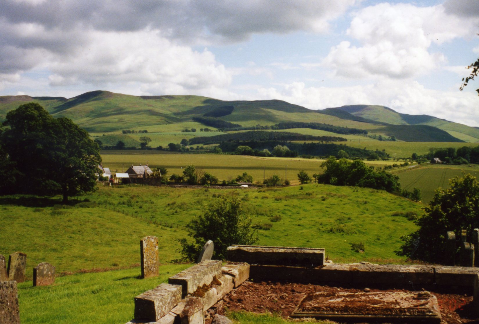
The church, situated on the summit of a circular hill, and approached by an avenue of stately trees, is of very great antiquity, and has been put into a state of substantial repair within the last fifty years; it affords accommodation to 200 persons, and, though at a great distance from the eastern part of the parish, is easily accessible to the great majority of the parishioners. The parochial school affords education to about forty children; the master's salary is £34, with £30 fees, and a house and garden. There are several mineral springs, of which one, on the farm of Bankhead, is deemed efficacious in scorbutic complaints. Jasper in large masses is frequently turned up by the plough in different parts.
The site of Linton Castle may still be traced on the summit of a hill near that on which the church is situated; but it has recently been planted with trees. On the summits of various other hills are remains of circular encampments, probably formed during the wars of the border; and in many places are tumuli, some of which have been opened, and found to contain urns of clay of circular form, inclosing human bones. Some of them are supposed to be of Roman origin; and in parts of the parish the tumuli are so numerous as to warrant the conjecture that it must have been the scene of some considerable battle. In repairing the church, a large grave was discovered containing fifty skulls, many of which showed marks of violence, and which are supposed to be those of warriors slain in the battle of Flodden Field; and in the moss, about three feet beneath the surface, was found within the last few years a Roman spear of brass.
________________
Editors Note: Originally published in A Topographical Dictionary of Scotland by Samuel Lewis Year published 1846, pages 175-197, (First Published in the LINTON & BIRD Chronicles Volume I, Issue 3, © Fall 1984), (Linton Research Fund Inc. Publication © 2011), (LINTON & BIRD CHRONICLES, Volume VI, Issue 1, Spring © 2011, ISSN 1941-3521).

Linton Research Fund, Inc., HOME PAGE
Thanks for visiting, come back when you can stay longer!
Below photo: view from Linton Church grave yard.